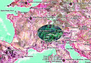
On the European scale, Switzerland is the north-south east-west axis of what politicians call 'old' Europe, which goes a long way toward explaining the international role such a small country plays in Europe and the world. You can see that Bern is more or less in the centre of Switzerland - a compromise point between the French, German, Italian and Romansch speaking Swiss, who might all wish for their own regions' major and better-known towns to be the capital.

At the regional level, Bern is situated just north of the Alps on the Swiss plateau, which spans west to east across the northern two-thirds of the country. The remainder of the country is sparesly inhabited Alpine terrain - the majority of the populace lives on the plateau. Lush countryside surrounds the town and the Alps are within easy reach, past the clean blue waters of Lake Thun :-)

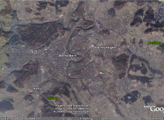
Zooming in, we see that Bern really is a very small town. The most prominent geographical features are the River Aare and the Gurten hill south of the town. The core of the Swiss capital is concentrated on the "half-island" (as it's called in German) made by the curve of the River Aare.
For more detail on Bern, take a look at this post where I made some notes on how the town was founded and on the city layout.
1 comment:
that is so kewl that you guys posted a map - i just posted one of the islands and it would be excellent if others did just so we can get a perspective on where everyone is located since my geography is so bad. Thanks for doing that for Bern! I met a couple from Switzerland visiting the islands a week ago.
Post a Comment